wmorgan1
13 Feb '21
https://london1878.com/
Stanford’s Geological Library Map Of London And Its Suburbs 1878
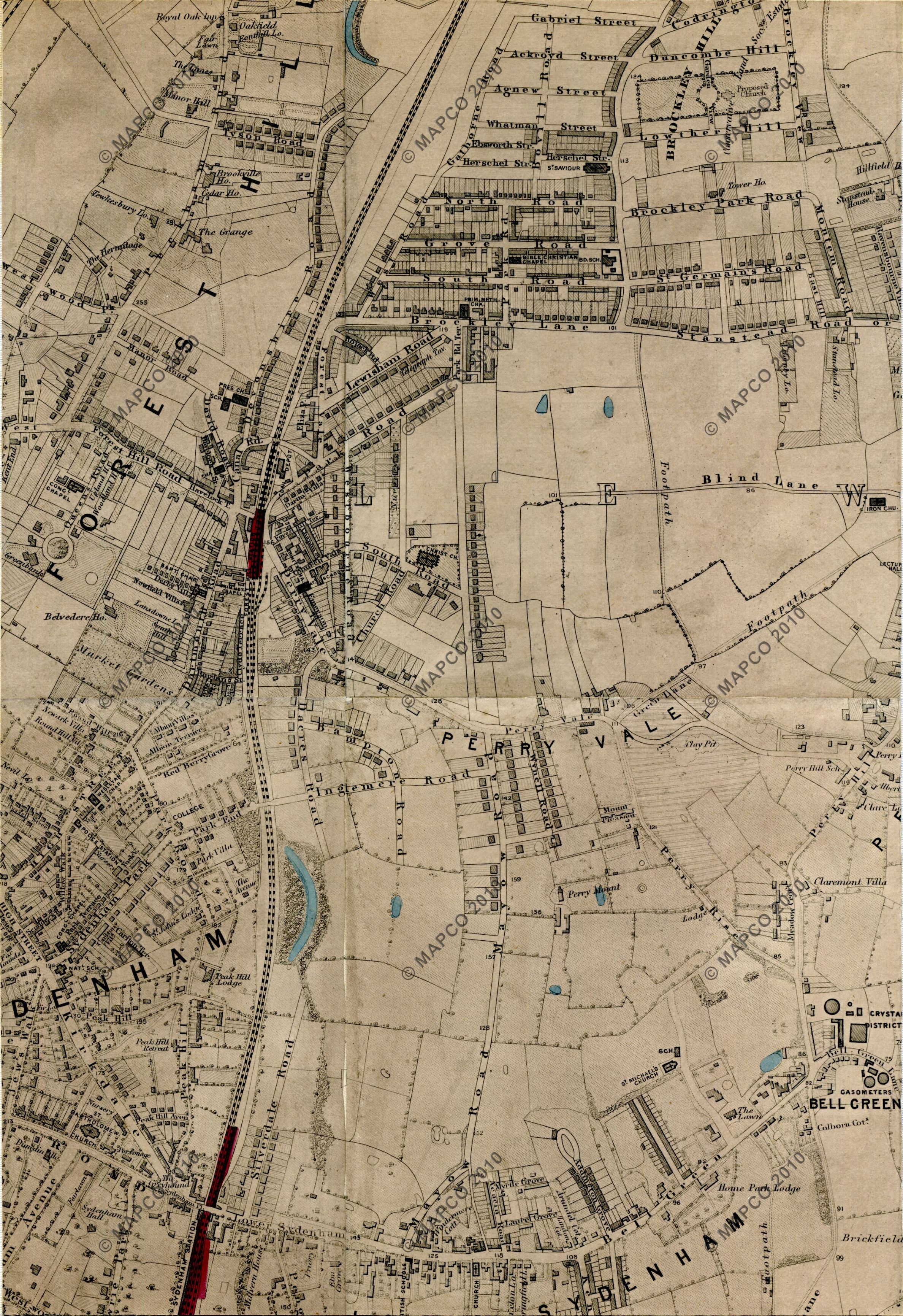
Stanfords Library Map Of London And Its Suburbs 1878, With Geological Colouring. Forest Hill area.

https://london1878.com/
Stanford’s Geological Library Map Of London And Its Suburbs 1878
Stanfords Library Map Of London And Its Suburbs 1878, With Geological Colouring. Forest Hill area.

Thanks for posting this - what a lovely clear map of our area, fascinating.

This is excellent. I have seen a few old maps of the area but I don’t think I’ve seen this one. Interesting to see how the road/street names have evolved.

I can spend hours on the National Library of Scotland’s Georeferenced maps. You can choose to overlay many different types of map and from different dates.

That’s fantastic - well worth a look. Thank for posting.
Very interesting, thanks for sharing. It looks like the only properties built on Bovill & nearby roads at this stage are the three story townhouses.