
On the way into work this morning, I was looking at Twitter when the following article from The Londonist popped up:
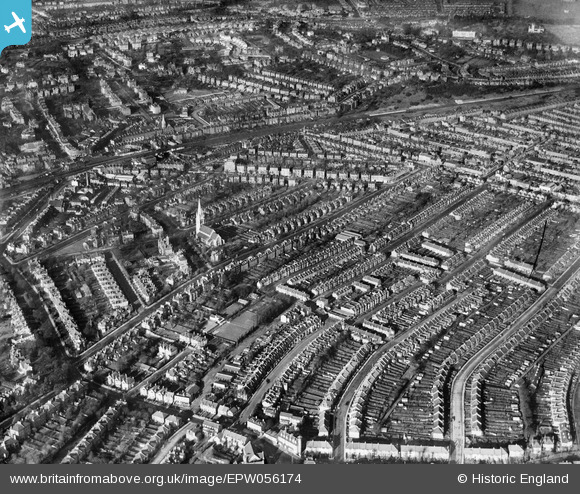
It’s 7 months or so old but I had never seen this before. Britain from Above Britain From Above has handily collated all these old aerial images and mapped them all. So, I decided to zoom in on Forest Hill and lo and behold saw there was one directly on my street (Sunderland Road). The image is attached… you will need to register to be able to zoom in and see other mapped points of interest in each photo… but I find this utterly fascinating… apparently on Sunderland Road at the top end near the South Circular was a large house… and all the houses on the west side of the road looked to be of the same type, whereas now there’s a few different types (I am imagining bomb damage fill ins post WW2??). I suspect this website will keep me busy for a while…