Archived on 6/5/2022

Camille Pissarro painting of Lordship Lane Station

ThorNogson
16 Apr '19

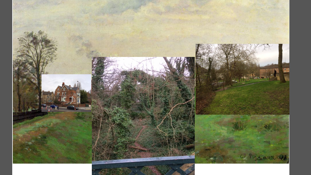
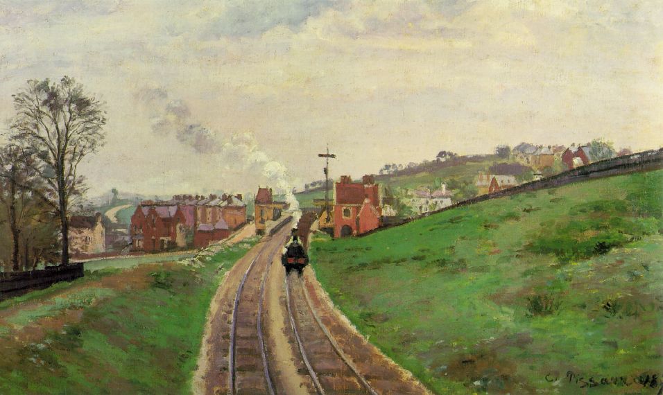
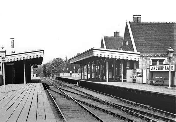
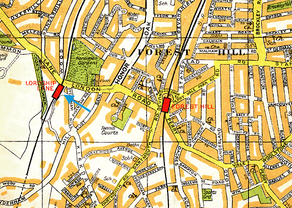
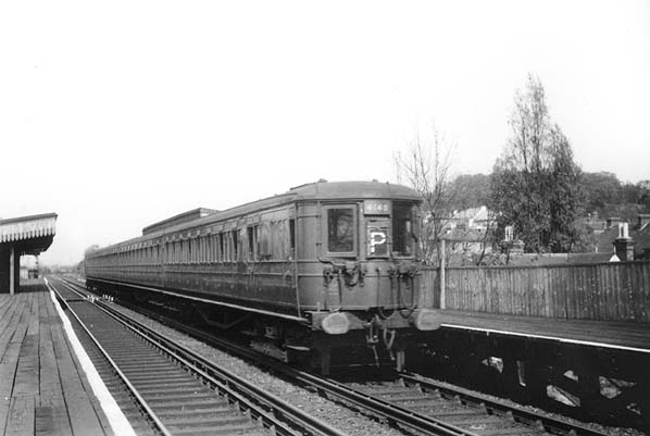
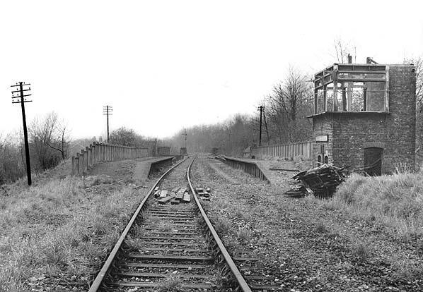
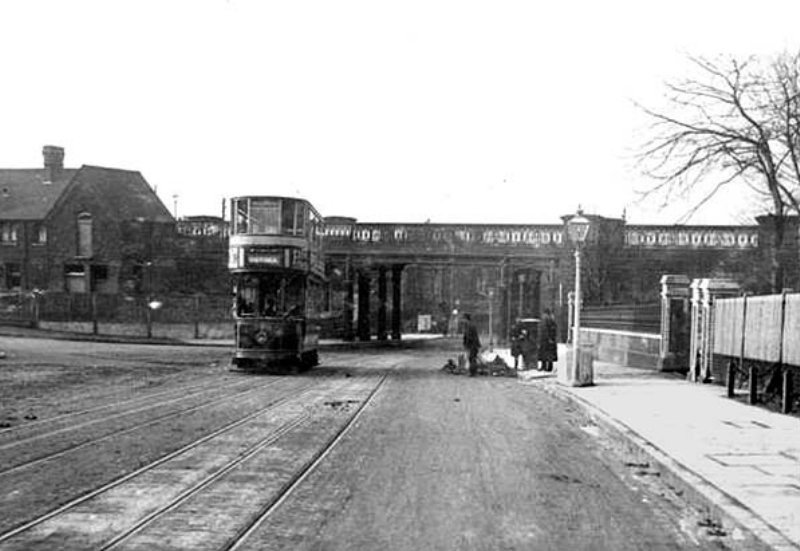
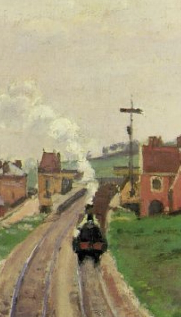
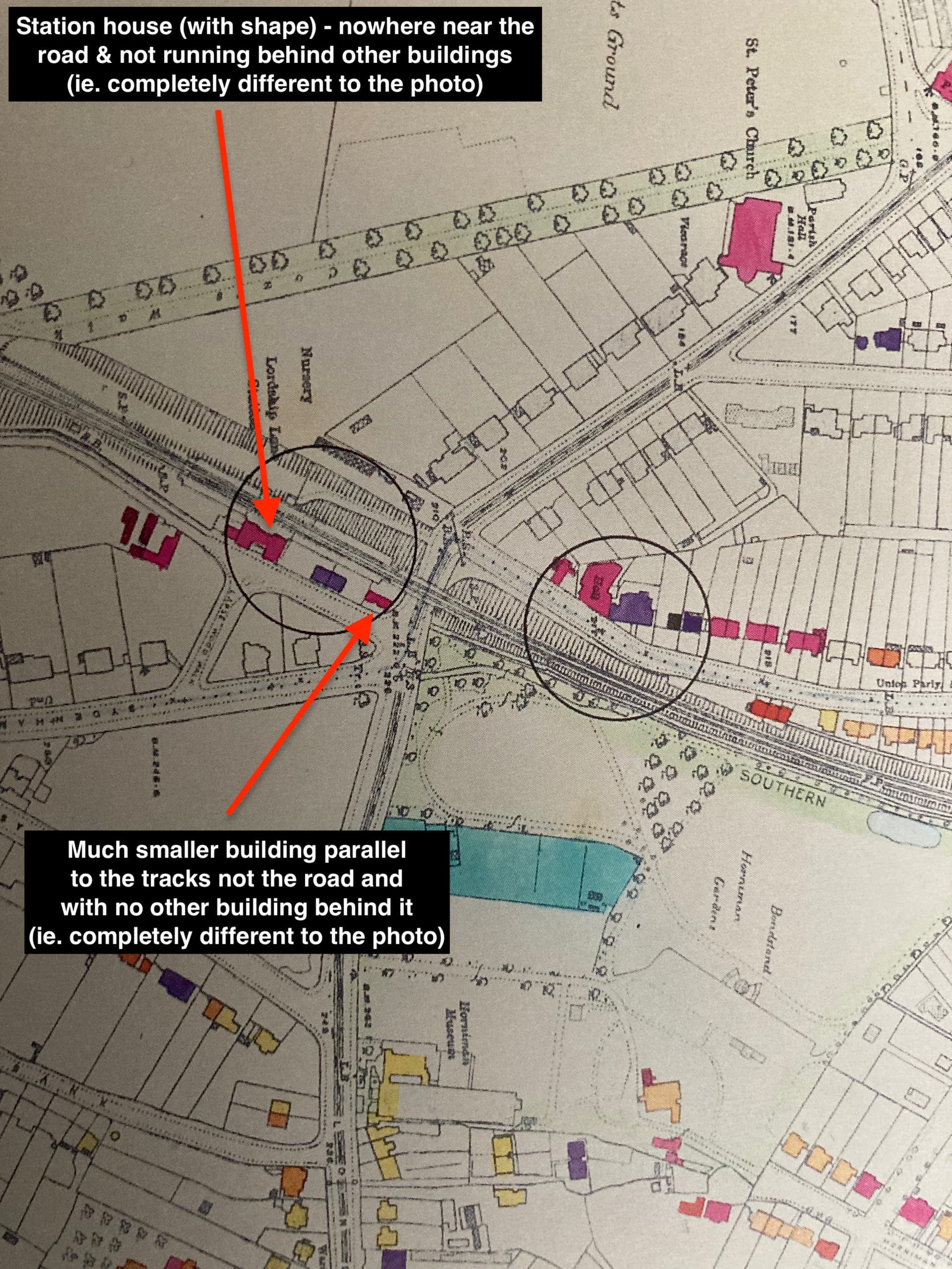
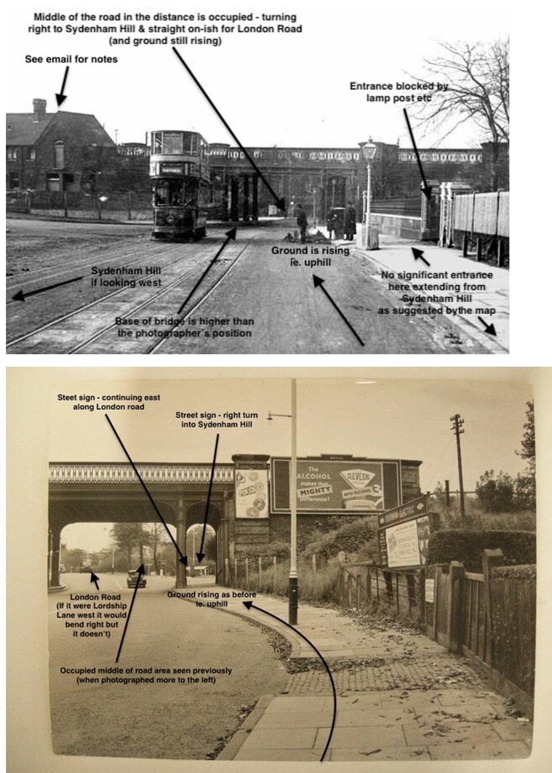
In the 1870’s the Impressionist painter Camille Pissarro painted Lordship Lane station from the bridge in Sydenham Hill Woods looking north at the Crystal Palace High Level Railway. What was open countryside then is all overgrown now, but there are a few visible pointers to the old railway track.

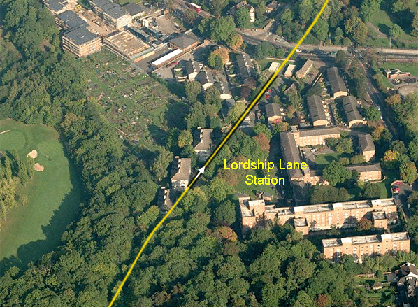
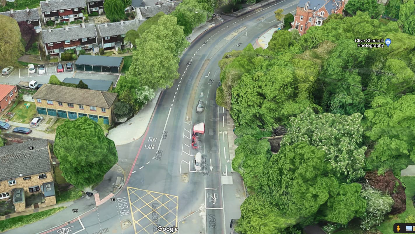
I’ve led walks for friends along the railway route from Nunhead to Crystal Palace a couple of times. Here’s an overlay of some current views with the painting to compare. The accuracy of his drafting, of the landscape and especially of the houses that are still there is, as you might expect, excellent.

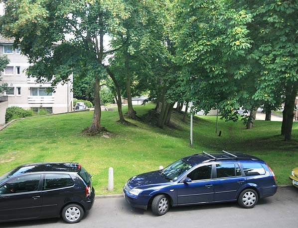
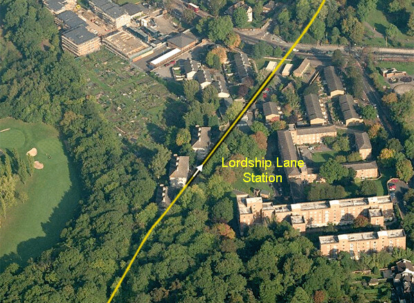
In his painting, centrally we see the railway line, then the station buildings, just beyond them was a bridge over Lordship Lane heading into the current Horniman Nature Trail, at the back of Woodvale. To the right in the distance we see the hill on which Horniman Gardens now stand. In the near right foreground now stand the apartment blocks of the Sydenham Hill Estate. Finally, left of centre, the red house with the cream house left of it on the corner of Woodvale.


starman
16 Apr '19

Great work on this.

I went to a lunchtime talk on this painting at the Courtauld Gallery back in 2016. And I’m pretty sure I spied it among the recent Courtauld Impressionists show at the National Gallery.

But I love reviewing this in a modern context.

anon5422159
16 Apr '19

Great post @ThorNogson

I was curious to know exactly where it is. This article has a bit of info including a map:

http://www.disused-stations.org.uk/l/lordship_lane/

Lordship Lane Station looking north in c. early 1920’s

Lordship Lane Station looking north in the early 1950’s

Photo from Brian Halford collection

Lordship Lane Station looking south during demolition in 1956
Photo by John L. Smith

The site of Lordship Lane Station looking north east in July 2007
Photo by Nick Catford

Aerial view showing the site of Lordship Lane Station - the platforms are shown in black. The arrow indicates the camera position and direction of the photograph above.

Click here for more pictures of Lordship Lane Station
Click here for pictures of Cox’s Walk footbridge south of Lordship Lane Station
Click here to see literature advertising the ‘Palace Centenarian’ - the last train

ThorNogson
16 Apr '19

yes indeed- this pic shows the bridge and the station building on the left. Horniman Gardens entrance to the right.

Edit. I no longer think that is the station building on the left. The station was set back further from the road.

and this is one side of the station, a 2 storey building with steps up to platform level.
image

margotwilson
17 Apr '19

He was a refugee
Who knows what talented refugees are among is today!

adlibber
13 Dec '21

1: Photo captioned *Lordship Lane Station looking south during demolition in 1956"

I know what ‘disused-stations.org’ say about this photo but assure you the photo is actually looking north not south. If it was looking south then Cox’s bridge in Upper Sydenham Wood would be visible - it isn’t! The tracks would also curve round to Cox’s bridge but they are straight. In addition, the signal box was on the Cox’s bridge side of the station which is why it’s near the camera, plus you can actually see the sides to the bridge over Lordship Lane/ London Road in the distance (ie. the north). Other photos on ‘disused-stations.org’ do show this correctly - use the first ‘click here’ link to see the ‘Late 1954’ and ‘Late 1956/7’ comparative photos, for example.

2: Photo captioned “yes indeed- this pic shows the bridge and the station building on the left. Horniman garden entrance to the right”

Sorry to say but it’s not the station building or garden entrance in view I’m afraid. This photo is taken looking east so the station is to the right of the bridge (ie. south) not the left and what is now the Horniman Museum Nature Trail is to the left of the bridge not the right (ie. north - it follows the old trackbed). Entrance to the Horniman Gardens is beyond the bridge to the left and therefore out of shot. Also, if you compare the building on the left in the photo with the station building in the last photo in the post you’ll see they are not at all similar. The rather decorative appearance of the station house (which was to the right) and the bridge resulted from the land being owned by Dulwich College who insisted on these designs when the railway was constructed. Also, ‘disused-stations.org’ correctly identifies the direction - available by using the first ‘click here’ link too.

clausy
13 Dec '21

This is indeed interesting… so the house in the pic is no longer there (would be on the corner where the blue ‘welcome to Lewisham’ sign is). The turning is therefore Wood Vale? Also the wall to the right with the brick piers are also no longer there. It’s quite difficult to get any bearings at all from the picture to be fair. It doesn’t even look like it’s uphill. Very odd.

I have to say it looks downhill and the turn to the left looks more like it’s Sydenhall Hill and that would put the station building to the left of the house in the picture. If it was looking uphill you’d see more of the underside of the bridge I think. And the road bends to the right under the bridge as it would do if you were going down the hill. But then is the wall to the right an old Horniman entrance? I’m so confused :slight_smile:

ThorNogson
13 Dec '21

Yes for all the reasons you state I’m not yet convinced, but I could be.

If we are looking towards Forest Hill was there ever a house on that corner of Woodvale? The photo is 1910 according to the disused station site.

I’ve walked the area with that pic in hand and managed to convince myself that it looks towards East Dulwich and that there is an old entrance to the Horniman there. More accurately I think it would have been an entrance to a house that was eventually incorporated into the Horniman gardens.

Maybe looking at some old maps showing houses would help.

Michael
13 Dec '21

I’m not sure either but I’ve grabbed a screenshot from a 1954 OS map:

To get your bearings look for the triangle. Lordship Lane station is to the west, and the footbridge is to the south of the map.
The dotted line marks the borough/county boundary but shows that there are no houses on the east wide of Wood Vale. The slope of the embankment and the narrowness of the side make it difficult to believe that there was a house on the west of Wood Vale when the bridge and railway were there. However was a building between Sydenham Hill and the railway.

I’m still of the opinion that the photo with the tram in is looking north and with Sydenham Hill on the left, but for all I know it could be a completely different location, anywhere in the UK.

ThorNogson
13 Dec '21

There are two station buildings in the Pissarro painting, one on the upside, one on the downside. The larger of the two is the ticket office , probably station masters house etc with a traditional gabled design.

The other side is smaller, you’d need a staircase inside to get to platform level.

ThorNogson
13 Dec '21

This is the bomb damage map for the area. It is an ordnance survey dated 1916. There is no building on the corner of Woodvale.

The building I referred to in the current grounds of Horniman is there, shaded blue and must have had its entrance into the main road.

The station building is set back some way from Lordship Lane, and there are other buildings close to the road.

So I still believe the photo looks west towards East Dulwich.

clausy
13 Dec '21

I think so too - this is pretty much it - I think that’s even the same tree with the same bend in one of the upright limbs. Sorry I didn’t fancy stepping into the road and I could only get a double decker and no tram.

adlibber
13 Dec '21

Well, what a can of worms eh? But it’s still looking east! The 5 photos I’m attaching should demonstrate this. Not sure why anyone thinks we are not looking uphill - the vanishing point in the distance is higher than the photographer so it must be. This is the correct angle (for looking east) and if it were downhill, the vanishing point would be lower, especially given the angle of the road. Much has changed but not the slope.

It’s a shame what happens beneath the bridge isn’t a little clearer but the original photo is over 100 years old. Photos 2 & 3 I’m attaching though are of the same view east and show the bridge from the same angle in the same setting. They also reveal clearly what is below the bridge in the distance ie. the turn right into Sydenham Hill and road straight on-ish along London Road. If it were Lordship Lane heading west, the road would turn sharply to the right - it doesn’t!

Notes are included on the photos. On photo 1 attached I didn’t have space to say that the details of the buildings on the left do not align with the map as they should if looking west (because it’s not west, of course!). I know the map posted isn’t a photo, obviously, but it’s detailed enough to reveal the shape of the station house (see photo 4). Given this fact, it is quite clear that the station house did not run behind the building immediately to the left of the tram and the building immediately to the left of the tram is parallel to the road whereas the map shows it parallel with the tracks. Given the detailed shape of the station house, it’s also reasonable to assume that the map is consistent in defining the shape of buildings. Therefore, it just isn’t the same building or space!

Photo 5 is the site of the station house in Lapse Wood Walk today - comparatively nowhere near Lordship Lane/ London Road etc.

You lot are stubborn & hard to please! Good - I like that!!

Best regards

The Adlibber

1. LL bridge

adlibber
13 Dec '21

Yes, the house & wall are no longer there and Wood Vale is to the left. It is uphill as explained in my most recent post - the lack of an underside to the bridge is to do with distance I think. Compare it with the other bridge photos & hopefully it’ll make sense.

If it were looking west, the turn on the right wouldn’t be Sydenham Hill. if you check the map that’s been posted you’ll see it would be a road that went along the front of the station. But, again, as explained in my most recent post, nothing aligns with the map as it should if that was true.

I don’t think you can see clearly that the road bends to the right beneath the bridge - check the other photos I’ve posted.

clausy
14 Dec '21

I think these 2 pictures exactly prove my point - one is from above looking down (can’t see the underside of the bridge) the other is looking up.

Where you claim ‘ground rising as before’ in the second picture there’s a huge curve to the left as you’d expect looking uphill and there’s no curve whatsoever in the one looking downhill, as you also see in my modern day picture.

The most obvious difference apart from the curve in the road is the angle of the bridge columns - they’re completely different when looking up as opposed to down. In the down view you see all three on the right side, in the up views they’re in a line.

applespider
14 Dec '21

I’ve walked that stretch of road almost every day for years and, to my eyes, @clausy has the right of it. I can’t make my eyes and brain see an uphill there and the road clearly curves on the other side down towards the Grove.

The extra pictures in my eyes are from the other side as they are clearly uphill and, as you say show London Road and Sydenham Hill.

clausy
14 Dec '21

We should try this…

Who wants to have a go - it’s open source… https://colmap.github.io

Michael
14 Dec '21

One thing I would note is that the turning on the left of the first photo is probably not Sydenham Hill, it is the other road that leads to the station and is now a small driveway with the double red line across it:

The railway bridge would have crossed the road where there are now garages, behind the yellow building with green garages, as shown in this image:

lordship_lane_aerial1

The curve on the tram tracks shows that it curves to the right, and the sepia photo, looking up the hill eastwards, shows how different it looks when looking towards the Horniman. The signage is present in the sepia photo at the entrance to the station. This isn’t shown in the photo with the tram as it is the other side of the bridge and the entrance to the station is on the left, not the right.

clausy
14 Dec '21

Yes, exactly - the first photo has tracks curving to the right, the one that says ‘everything the same as before’ has them curving to the left.

daz
14 Dec '21

I can remember an appeal in the Railway Magazine in 1968 from art experts for help in identifying this Pissaro. The station had already disappeared and I think peopled were stumped for sometime.

adlibber
15 Dec '21

It was thought to be Penge station before being identified as Lordship Lane. One point of interest is that it contains no people but somehow the Courtauld Institute know there was originally someone cutting grass on the right but Pissarro painted the grass-cutter out.

adlibber
15 Dec '21

I’m liking Michael’s first photo from above and the rationale of the track direction - it’s likely west. What idiot would ever have thought east? Only a fool, obviously!

Best regards

The Adlibber

marymck
16 Dec '21

Fascinating. How do they know that? Did he keep a diary?

adlibber
16 Dec '21

Regrettably that wasn’t explained but the Courtauld have the painting so maybe also a diary or notes or perhaps x-rays. It was mentioned in only a very short article I read here:

https://sites.courtauld.ac.uk/aah/camille-pissarro-lordship-lane-station-dulwich-1871/

Reference is made here to the painting being of Penge station in a Norwood Society article from 1963:

https://www.norwoodsociety.co.uk/articles/73-pissarro-an-additional-piece.html

If you’re interested, there’s a 12 minute talk (podcast) at the Courtauld about the painting and the artist you might enjoy that can be found here:

Best regards

The Adlibber

daz
16 Dec '21

Great links.
In the days of steam railway cuttings and embankments were always kept free of vegetation to prevent fires so highly likely there was someone scything away and spoiling the composition.

ThorNogson
21 Feb '22

this pic appeared on Twitter recently, the original wooden bridge from which Pissarro painted Lordship Lane station. Don’t know the date - guessing around 1900 from the dress of the two children pictured?

daz
21 Feb '22

What a lot of work went into that bridge, look at the balustrade.
The present bridge has been closed for years. I believe this is because the western brick abutment has been damaged by tree roots and then two tree preservation orders were placed on the trees causing the damage under pressure from tree enthusiasts. Am I right in this?
If so perhaps the Ramblers Association should be contacted as they are hot on keeping rights of way open and they could counterbalance the tree lobby!
I think the trees should come down, there are plenty more in the wood.

ThorNogson
21 Feb '22

The original bridge was rather fine wasnt it. This would be down to the Dulwich Estate which, when agreeing to the new railway line on their land, set high design values on the bridges to be used in their area. You can see that in the remaining ornate rail bridges in the Dulwich/ Herne Hill area. And also the lost Lordship Lane bridge shown in this thread. I don’t know of any other footbridges like the one in Sydenham Woods though.

https://www.facebook.com/106986070934851/posts/443196633980458/?d=n

There are updates here. Sounds as though Southwark Council are well aware of their obligations, but v slow to take action, and the bridge remains closed.

PennieH
23 Feb '22

The footbridge has now been closed for two years. This is not because of cracks in the wall, but the timber superstructure (only about 20 years old) had been allowed to rot and huge chunks were falling off.
The oak trees have not caused the damage to the wall but they are very close to it, which means more care would be needed to repair the abutment with them in place. This is what Southwark is supposed to be working out how to do, but the last update from them was March 2021. Hopefully they will produce a report and consult on it over the summer in time for the work to be done autumn/winter 2022. The official bird breeding season starts on Tuesday, so no work could be done now until the autumn.

system
27 Apr '22